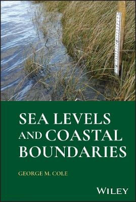
Sea Levels and Coastal Boundaries
John Wiley & Sons Inc (Verlag)
978-1-394-21688-8 (ISBN)
Sea Levels and Coastal Boundaries is a comprehensive resource for making critical decisions regarding the issue of coastal boundaries, planning, and regulation amidst climate change and rising sea levels, providing guidance in understanding of how sea level is changing, how society has defined the boundaries between public waters and bordering uplands as well as national offshore boundaries, and how such boundaries are defined and located. This book defines boundaries in public trust tidal waters, non-tidal waters, and boundaries for riparian and littoral rights and describes practices for determining boundaries where shorelines have been altered due to sea level change in the short and long term.
Included case law examples and exhibits cover complex legal issues such as navigability, riparian rights, and interstate compact agreements. The text also contributes to the issues of justice, safeguarding the environment, and related topics by providing clarity on the protection of public domain waters as well as private property rights.
Written by a leading surveying expert with decades of experience in the field of riparian and littoral boundaries, Sea Levels and Coastal Boundaries includes information on:
High and low water marks, tidal boundaries, and the legal status of artificial water bodies such as reservoirs and canals
Waters in the public trust, covering their general criteria, navigability-in-fact versus navigability-in-law, and non-navigable coves and tributaries
Boundary definitions of public trust tidal waters in various jurisdictions, covering Anglo-American Common Law, North-Atlantic Low Water States, and Civil Law
U.S. national and state maritime boundaries, covering boundaries including bays, entrance points (headlands), and obstructed entrances
Sea Levels and Coastal Boundaries is an essential reference for attorneys, surveyors, engineers, coastal planners, oceanographers, land developers, and others dealing with coastal or riparian lands or sea levels in their respective careers, as well as students in related programs of study.
George M. Cole is a professional engineer, surveyor, and geographer. His background includes service as a commissioned officer (final rank Lt. Commander) of the U.S. Coast & Geodetic Survey (now NOAA), the State Cadastral Surveyor for Florida, a private consultant directing private surveying and mapping operations in both the United States and Latin America, a visiting professor at the University of Puerto Rico, and an adjunct professor at Florida State University.
Preface ix
1 Sea Level Dynamics 1
1.1 Short-Term Sea Level Variation (Other than Tides) 1
1.1.1 Surface Gravity Waves 1
1.1.2 Seiches 2
1.1.3 Storm Surges 3
1.1.4 Tsunamis 4
1.2 Tidal Variation and Datum Planes 5
1.2.1 Tidal Cycles 5
1.2.2 Tidal Datum Planes 11
1.3 Long-Term Changes in Sea Level 13
1.3.1 Pre-Historic Trends 13
1.3.2 Contemporary Trends 17
1.3.3 Tidal Epochs 21
1.4 Shoreline Dynamics 22
1.5 Variations in Nontidal Waters 22
2 The Public Trust Doctrine 25
2.1 Origins of the Public Trust Doctrine 25
2.2 Application of the Public Trust Doctrine in the United States 26
2.2.1 Ownership of Tidal Waters 26
2.2.2 Ownership of NonTidal Waters 28
2.2.3 Application to Adjoining Non-Navigable Areas 29
2.2.4 Floodplains Adjoining Navigable Waters 30
3 Boundaries in Public Trust Tidal Waters 33
3.1 Boundary Definitions in Various Jurisdictions 33
3.1.1 Anglo-American Common Law 33
3.1.2 North-Atlantic Low Water States 35
3.1.3 Civil Law 36
3.2 Local Tidal Data Determination 40
3.2.1 Local Variation 40
3.2.2 Tidal Data Calculations 43
3.2.2.1 Standard (Range Ratio) Method of Simultaneous Comparison 43
3.2.2.2 Example of Tidal Data Calculation (Standard Method) 45
3.2.2.3 Example of Tidal Data Calculation (Range Ratio Method) 48
3.3 Tidal Datum Line Location 49
3.4 Extent of Tidal Influence 50
4 Boundaries in Public Trust Nontidal Waters 53
4.1 River and Lake Boundary Definitions 53
4.2 Nontidal Water Boundary Determination 54
4.2.1 The Ordinary High Water Mark 54
4.2.2 The Ordinary Low Water Mark 63
4.3 Use of Government Land Office Meander Lines as Boundaries 64
4.3.1 To Meander or Not to Meander 64
4.3.2 Legal Significance of Meandering 66
4.3.3 Location of Meander Lines 67
4.3.3.1 Pertinent Instructions 67
4.3.3.2 Legal Significance of Location 68
4.4 Case Studies for Nontidal Boundaries (Cole 1997) 69
5 U.S. National and State Maritime Boundaries 75
5.1 National Maritime Boundaries 75
5.1.1 Bays 78
5.1.2 Entrance Points (Headlands) 79
5.1.3 Equidistant/Median Lines 81
5.2 State Maritime Boundaries 83
6 Boundaries for Littorial and Riparian Rights in Public Trust Waters 87
6.1 Riparian and Littoral Rights 87
6.2 Riparian Rights in Adjacent Waters 87
6.3 Riparian Rights to Newly Formed Land 94
6.4 Dealing with Avulsion or Altered Shorelines 95
References 99
Case Law Cites 99
7 Sea Levels and Coastal Boundaries Yesterday–Today–Tomorrow 101
7.1 Sea Levels and Coastal Boundaries – Yesterday 101
7.2 Sea Levels and Coastal Boundaries – Today 103
7.2.1 Long-Term Trends 103
7.2.2 Recent Trends in Sea Level 105
7.2.3 Variations in Rate of Change 110
7.2.4 Impact on Coastal Boundaries 112
7.3 Sea Levels and Coastal Boundaries – Tomorrow 112
References 113
Index 115
| Erscheinungsdatum | 26.07.2024 |
|---|---|
| Verlagsort | New York |
| Sprache | englisch |
| Maße | 158 x 231 mm |
| Gewicht | 295 g |
| Themenwelt | Naturwissenschaften ► Geowissenschaften ► Geografie / Kartografie |
| Technik ► Bauwesen | |
| Technik ► Umwelttechnik / Biotechnologie | |
| ISBN-10 | 1-394-21688-2 / 1394216882 |
| ISBN-13 | 978-1-394-21688-8 / 9781394216888 |
| Zustand | Neuware |
| Informationen gemäß Produktsicherheitsverordnung (GPSR) | |
| Haben Sie eine Frage zum Produkt? |
aus dem Bereich


