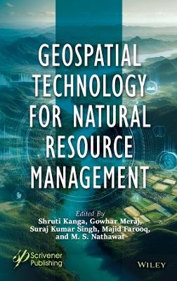
Geospatial Technology for Natural Resource Management
Wiley-Scrivener (Verlag)
978-1-394-16636-7 (ISBN)
- Noch nicht erschienen (ca. Mai 2026)
- Versandkostenfrei
- Auch auf Rechnung
- Artikel merken
The first step in developing a sustainable resource strategy is assessing the availability and condition of resources. This involves evaluating baseline levels, identifying trends, and understanding their consequences. Mitigation policies are then developed based on this assessment. Modern geospatial technologies like Remote Sensing (RS), Geographic Information Systems (GIS), and Global Positioning Systems (GPS) offer powerful tools for surveying, mapping, and monitoring both renewable and nonrenewable resources. These technologies support global environmental protection, disaster management, and sustainable development by providing repetitive and global data. GPS provides accurate geographic coordinates, while GIS allows visualization, analysis, and decision-making through spatial data, enabling the study of complex environmental and natural resource challenges at various scales.
Shruti Kanga, PhD, is an assistant professor in the Centre for Land Resource Management, Central University of Jharkhand, Ranchi. Her main areas of interest include forest fire risk modeling and management, tourism, and resource management. She has attended and organized over 35 national and international conferences. She has over 12 years of teaching and research experience. She was also the course coordinator for different modules of the EDUSAT based distance learning program organized by the Indian Institute of Remote Sensing, ISRO Indian Space Research Organization, Government of India. Gowhar Meraj, PhD, works in the field of remote sensing, watershed management, hydrology, disaster risk assessment and mitigation, simulation modelling, and spatial analysis. He is the principal investigator of a Department of Science and Technology, Government of India sponsored research project where he assesses the impact of climate change on the critical ecosystem services of the Kashmir Valley. His work is with INVEST modelling for assessing sediment retention services, water yield services, and habitat quality in the Kashmir valley. He has more than 40 research publications. Suraj Kumar Singh, PhD, is an assistant professor at the Centre for Land Resource Management, Central University of Jharkhand, Ranchi. He over 12 years of teaching and research experience in the areas of waterlogging and flood hazards, geospatial applications in water resources, disaster management, hydrogeomorphology, urban planning, and wasteland mapping. He was previously a course coordinator for different modules of the EDUSAT based distance learning program organized by the Indian Institute of Remote Sensing, Indian Space Research Organization, Government of India. Majid Farooq, PhD, is a working scientist in the Department of Ecology, Environment and Remote Sensing, Government of Jammu and Kashmir, India. He has more than 15 years of experience in research, teaching, and consultancy related to remote sensing and GIS such as climate change vulnerability assessments, flood modeling, ecosystem assessment, watershed management, natural resource management, ecosystem services, and modeling. M. S. Nathawat, PhD, is a scientist of international repute. He has more than 150 publications in various international and national journals. His primary areas of research include remote sensing, natural resource management, environmental assessments, desertification, remote sensing and GIS, natural resources management, physical geography, regional and urban planning, environmental geomorphology, climate change and disaster management. He is also a member of expert committees in various national bodies.
| Erscheint lt. Verlag | 5.5.2026 |
|---|---|
| Sprache | englisch |
| Themenwelt | Naturwissenschaften ► Biologie ► Ökologie / Naturschutz |
| Naturwissenschaften ► Geowissenschaften ► Geologie | |
| ISBN-10 | 1-394-16636-2 / 1394166362 |
| ISBN-13 | 978-1-394-16636-7 / 9781394166367 |
| Zustand | Neuware |
| Haben Sie eine Frage zum Produkt? |
aus dem Bereich


