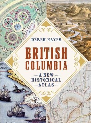
British Columbia
A New Historical Atlas
Seiten
2020
Douglas & McIntyre (Verlag)
978-1-77162-211-0 (ISBN)
Douglas & McIntyre (Verlag)
978-1-77162-211-0 (ISBN)
Over 900 maps plus 300 illustrations and photographs tell the story of the planners, schemers, gold seekers and fur traders who built Canada’s westernmost province.
Early depictions of the West Coast were no more than cartographers’ fanciful guesses. Not until the discovery of “soft gold”—sea otter pelts—and the quest to find a Northwest Passage did explorations, such as the epic voyage of George Vancouver, lead to a better understanding of the region’s geography. Even so, until the gold rush of 1858, the interior of the province was mostly unknown except for the routes blazed by fur traders. Thirteen years later, British Columbia became a province of Canada, and a transcontinental railway was built to connect the land west of the Rocky Mountains with the rest of the country.
The efforts of these early explorers, fur traders, gold seekers and builders involved the production of maps that showed what they had found and what they proposed to do. British Columbia: A New Historical Atlas reveals the plans and strategies that created the province we know today through a fascinating visual lens—from maps by early Indigenous inhabitants and the Europeans who arrived to explore and exploit vast resource wealth, to maps drawn by those who, decades later, prepared for war, built dams, promoted real estate and even tracked murders.
Presented alongside award-winning historian Derek Hayes’s lively and authoritative text, this unprecedented collection of over 900 maps plus 300 photos and historical documents offers a unique, geographical history. This is the story of both the dreams that came true and those that didn’t—yet all are part of the dramatic tale of the forging of Canada’s western frontier.
Derek Hayes holds two degrees in geography and has a passion for old maps and what they can reveal about the past. He is the author of the bestselling Historical Atlas Series (Douglas &McIntyre), which includes the Historical Atlas of Canada, Historical Atlas of Vancouver and the Lower Fraser Valley, Historical Atlas of Toronto and Historical Atlas of Early Railways. He lives in White Rock, BC.
| Erscheinungsdatum | 29.12.2018 |
|---|---|
| Zusatzinfo | maps, illustrations and photographs |
| Verlagsort | Toronto |
| Sprache | englisch |
| Maße | 254 x 342 mm |
| Themenwelt | Sachbuch/Ratgeber ► Geschichte / Politik ► Allgemeines / Lexika |
| Reiseführer ► Nord- / Mittelamerika ► Kanada | |
| Naturwissenschaften ► Geowissenschaften ► Geografie / Kartografie | |
| ISBN-10 | 1-77162-211-3 / 1771622113 |
| ISBN-13 | 978-1-77162-211-0 / 9781771622110 |
| Zustand | Neuware |
| Haben Sie eine Frage zum Produkt? |
Mehr entdecken
aus dem Bereich
aus dem Bereich
Nordwesten : mit Routen durch Südwest-Kanada
Buch | Softcover (2024)
Reise-Know-How (Verlag)
CHF 39,90


