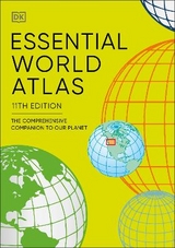
Essential World Atlas
The comprehensive companion to our planet
Seiten
2019
DK (Verlag)
978-0-241-36425-3 (ISBN)
DK (Verlag)
978-0-241-36425-3 (ISBN)
- Titel erscheint in neuer Auflage
- Artikel merken
Zu diesem Artikel existiert eine Nachauflage
Full of clear and detailed maps, this beautifully designed world atlas is the perfect companion to discover our planet.
Originally published in 1997 and now in its 10th edition, the Essential World Atlas
includes all recent border, place name, and flag changes around the world,
including the new nation of South Sudan and the annexation of Crimea.
A series of 12 global thematic maps on subjects as diverse as Ocean currents and languages give a general introduction to the World today. These are followed by the main atlas which includes over 60 full colour regional maps featuring political and state
borders; main population and administrative centres; main lines of communication, ports and airports.
In addition to these maps this clear, informative and affordable atlas also includes a fully cross-referenced index-Gazetteer featuring 20,000 places, data profiles of each country, plus a glossary of geographical terms making it the perfect reference tool to distil the mass of information in today's world into the essential facts needed to help understand our ever-changing planet.
| Erscheinungsdatum | 28.05.2019 |
|---|---|
| Reihe/Serie | DK Reference Atlases |
| Verlagsort | London |
| Sprache | englisch |
| Maße | 152 x 215 mm |
| Gewicht | 560 g |
| Themenwelt | Reisen ► Karten / Stadtpläne / Atlanten ► Welt / Arktis / Antarktis |
| Naturwissenschaften ► Geowissenschaften ► Geografie / Kartografie | |
| ISBN-10 | 0-241-36425-6 / 0241364256 |
| ISBN-13 | 978-0-241-36425-3 / 9780241364253 |
| Zustand | Neuware |
| Informationen gemäß Produktsicherheitsverordnung (GPSR) | |
| Haben Sie eine Frage zum Produkt? |
Mehr entdecken
aus dem Bereich
aus dem Bereich
mit Fakten und Infos zu allen Kontinenten
Buch | Hardcover (2024)
Kosmos Kartografie in der Franckh-Kosmos Verlags-GmbH & Co. …
CHF 35,90


