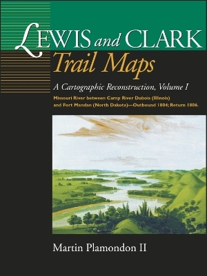
Lewis and Clark Trail Maps
A Cartographic Reconstruction, Volume I: Missouri River between Camp River Dubois (Illinois) and Fort Mandan (North Dakota) - Outbound 1804; Return 1806
Seiten
2000
Washington State University Press (Verlag)
978-0-87422-232-6 (ISBN)
Washington State University Press (Verlag)
978-0-87422-232-6 (ISBN)
- Titel nicht im Sortiment
- Artikel merken
The Lewis and Clark Expedition bicentennial is producing an unprecedented flurry of interest in the United States, and an array of commemorative activities are being planned in the regions visited by the Corps of Discovery.During the 28-month trek (1804-06), Captain William Clark dutifully surveyed the expedition's route by taking continual compass readings to determine directions while estimating distances between geographic points. Clark assumed that his painstakingly recorded "surveyed traverse" would be converted into well-crafted, accurate maps by cartographers soon after the journey's completion. For a variety of reasons, this did not occur--until now.
By using measurements, notes, maps, and sketches in Clark's records as well as other sources, Martin Plamondon II has accomplished the cartographic reconstruction that Clark expected upon the expedition's return. Volume I is the first of a three-volume set delineating the Corps' journey.
The first volume includes 153 full-page maps of the Missouri River from Illinois to North Dakota. In addition to presenting key geographic and historic features, the maps compare the modern beds of rivers to their courses at the time of the exploration. The contrast is striking between what Lewis and Clark saw and what we see today. The ever meandering Missouri River, in particular, has changed its channel hundreds of times since the men of the expedition fought its currents. Even Clark commented on the return trip in 1806 that some sections fo the river were barely recognizable compared to when they passed by two years earlier. Modern America likewise has wrought great change.
Of further interest in Volume I are the many excerpts from the expedition diaries, an insightful essay on frontier surveying, and cartographic indexes. Plamondon's years of careful cartographic reconstruction have resulted in a captivating and never-before-seen record of the American West.
Martin Plamondon II of Vancouver, Washington, was a chairman of the Governor's Washington Lewis and Clark Trail Committee. His long-term research in exploration history and 28 years of experience as a professional cartographer provided the unique set of skills required to complete the trail maps.
Acknowledgments
Introduction
SourcesINDEX MAPS AND LEGEND, VOLUME I
Plates I-IV
LEWIS AND CLARK TRAIL MAPS, VOLUME I
Map Numbers 1-153
INDEXES, VOLUME I
Outbound and Return Camps
Outbound and Return Dates
Selected Locations and Events
Place Names
| Erscheint lt. Verlag | 13.9.2000 |
|---|---|
| Verlagsort | Pullman, WA |
| Sprache | englisch |
| Maße | 229 x 305 mm |
| Gewicht | 1216 g |
| Themenwelt | Reisen ► Karten / Stadtpläne / Atlanten ► Nord- / Mittelamerika |
| Reisen ► Karten / Stadtpläne / Atlanten ► Welt / Arktis / Antarktis | |
| Geschichte ► Allgemeine Geschichte ► Neuzeit (bis 1918) | |
| Geisteswissenschaften ► Geschichte ► Regional- / Ländergeschichte | |
| Geisteswissenschaften ► Geschichte ► Teilgebiete der Geschichte | |
| Naturwissenschaften ► Geowissenschaften ► Geografie / Kartografie | |
| ISBN-10 | 0-87422-232-X / 087422232X |
| ISBN-13 | 978-0-87422-232-6 / 9780874222326 |
| Zustand | Neuware |
| Haben Sie eine Frage zum Produkt? |
Mehr entdecken
aus dem Bereich
aus dem Bereich
Europa 1848/49 und der Kampf für eine neue Welt
Buch | Hardcover (2023)
DVA (Verlag)
CHF 67,20
Giordano Bruno - ein ketzerisches Leben
Buch | Hardcover (2024)
C.H.Beck (Verlag)
CHF 41,85


