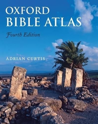
Oxford Bible Atlas
Seiten
2009
|
4th Revised edition
Oxford University Press (Verlag)
978-0-19-956046-2 (ISBN)
Oxford University Press (Verlag)
978-0-19-956046-2 (ISBN)
This new edition, now with full-colour maps and illustrations, has been thoroughly revised to bring it up to date with regard both to biblical scholarship and to archaeology and topography. The Atlas provides a superb guide to the geography of the Holy Land throughout biblical history, from the Exodus period through to New Testament times.
This new edition of the Oxford Bible Atlas, now with full-colour maps and illustrations, has been thoroughly revised to bring it up to date with regard both to biblical scholarship and to archaeology and topography. The Atlas will help readers of the Bible understand the contexts in which its stories are set and to appreciate the world from which it emerged and which formed its background. Maps show the geographical setting of the Bible's stories and reflect the successive stages of the Bible's accounts, while specially chosen full-colour illustrations bring the countries and their peoples to life. The accompanying text describes the land of Palestine, and its wider ancient Near Eastern and east Mediterranean settings. It outlines clearly the successive historical periods, and describes the major civilizations with which Israelites, Jews, and early Christians came into contact. There is also an illustrated survey of the relevance of archaeology for the study of the Bible. The Atlas provides a superb guide to the geography of the Holy Land throughout biblical history, from the Exodus period through to New Testament times.
This new edition of the Oxford Bible Atlas, now with full-colour maps and illustrations, has been thoroughly revised to bring it up to date with regard both to biblical scholarship and to archaeology and topography. The Atlas will help readers of the Bible understand the contexts in which its stories are set and to appreciate the world from which it emerged and which formed its background. Maps show the geographical setting of the Bible's stories and reflect the successive stages of the Bible's accounts, while specially chosen full-colour illustrations bring the countries and their peoples to life. The accompanying text describes the land of Palestine, and its wider ancient Near Eastern and east Mediterranean settings. It outlines clearly the successive historical periods, and describes the major civilizations with which Israelites, Jews, and early Christians came into contact. There is also an illustrated survey of the relevance of archaeology for the study of the Bible. The Atlas provides a superb guide to the geography of the Holy Land throughout biblical history, from the Exodus period through to New Testament times.
Adrian Curtis is Senior Lecturer in Hebrew Bible at the University of Manchester.
THE SETTING; THE HEBREW BIBLE; THE NEW TESTAMENT; ARCHAEOLOGY IN BIBLE LANDS
| Erscheint lt. Verlag | 16.4.2009 |
|---|---|
| Zusatzinfo | 27 colour maps, 81 colour illustrations |
| Verlagsort | Oxford |
| Sprache | englisch |
| Maße | 208 x 276 mm |
| Gewicht | 755 g |
| Themenwelt | Geisteswissenschaften ► Archäologie |
| Geisteswissenschaften ► Geschichte ► Teilgebiete der Geschichte | |
| Religion / Theologie ► Christentum ► Bibelausgaben / Bibelkommentare | |
| Religion / Theologie ► Christentum ► Kirchengeschichte | |
| Schlagworte | Bibelatlas |
| ISBN-10 | 0-19-956046-3 / 0199560463 |
| ISBN-13 | 978-0-19-956046-2 / 9780199560462 |
| Zustand | Neuware |
| Haben Sie eine Frage zum Produkt? |
Mehr entdecken
aus dem Bereich
aus dem Bereich
Buch | Softcover (2021)
De Gruyter (Verlag)
CHF 45,90
wie wir uns unsere spirituelle Heimat zurückholen
Buch | Hardcover (2024)
Patmos Verlag
CHF 27,95


