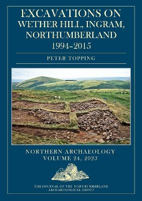
Excavations on Wether Hill, Ingram, Northumberland, 1994–2015
Oxbow Books (Verlag)
978-1-78925-969-8 (ISBN)
The Northumberland Archaeological Group’s (NAG) Wether Hill project spanned the years 1994–2015 and was located on the eponymous hilltop overlooking the mouth of the Breamish Valley in the Northumberland Cheviots. The project had been inspired by the RCHME’s ‘Southeast Cheviots Project’ that had discovered and recorded extensive prehistoric and later landscapes.
The NAG project investigated several sites. Over the 11 seasons of excavation, NAG recorded evidence of residual Mesolithic activity (microliths), a burial cairn containing two Beakers in an oak coffin, which was superseded by a stone-built cist containing three Food Vessels, Iron Age cord rig cultivation and clearance cairns, a series of Middle/Late Iron Age timber-built palisaded enclosures, a cross-ridge dyke, which protected the southern approach to the Wether Hill fort, and sampled the multi-period bivallate hillfort.
The hillfort sequence on Wether Hill began with a succession of palisaded enclosures, which were later replaced by bivallate earth and stone defenses; both phases appear to have been associated with timber-built houses. Eventually the fort was abandoned, and three stone-built roundhouses were constructed in the fort. The 18 radiocarbon dates obtained from various contexts in the hillfort makes this site one of the better dated forts in the Borders.
The chronology of the Wether Hill fort spanned the Middle/Late Iron Age, which corresponds with dates from palisaded enclosures excavated elsewhere on the hilltop spur. Taken together, this evidence provides a snapshot of settlement hierarchies and agricultural practices during the later Iron Age in this part of the Northumberland Cheviots. The excavations also help contextualise some of the RCHME survey evidence, providing data to model chronology, potential prehistoric settlement density and land-use patterns at different time periods in the well-preserved archaeological landscapes of the Cheviots.
Pete Topping was head of survey for English Heritage and is an expert in landscape interpretation. Following voluntary early retirement he returned to his main subject of research, undertaking a recently awarded PhD at Newcastle University on flint and stone extraction industries. He is on Oxbow's American Landscapes Editorial Board.
Author details
Abstract
Acknowledgements
Editorial
1 Introduction
2 A geoarchaeology of Wether Hill, and summary of the palaeo-environmental history
Michael J. Allen
3 Area 1: the cross-ridge dyke
4 Area 2: the field system
5 Area 3: the Beaker/Food Vessel pit and palisaded enclosures
6 Area 4: the round cairn
7 Area 5: the hillfort
8 The stone implement assemblages
John Davies, David Field and Peter Topping
9 The pottery assemblages
Alex Gibson, Andrew Sage and Peter Topping
10 Wether Hill hillfort and its context – a discussion
David McOmish
Bibliography
| Erscheinungsdatum | 01.08.2023 |
|---|---|
| Zusatzinfo | Color images |
| Verlagsort | Oxford |
| Sprache | englisch |
| Maße | 210 x 298 mm |
| Themenwelt | Geisteswissenschaften ► Archäologie |
| Geschichte ► Allgemeine Geschichte ► Mittelalter | |
| Geisteswissenschaften ► Geschichte ► Regional- / Ländergeschichte | |
| ISBN-10 | 1-78925-969-X / 178925969X |
| ISBN-13 | 978-1-78925-969-8 / 9781789259698 |
| Zustand | Neuware |
| Informationen gemäß Produktsicherheitsverordnung (GPSR) | |
| Haben Sie eine Frage zum Produkt? |
aus dem Bereich


