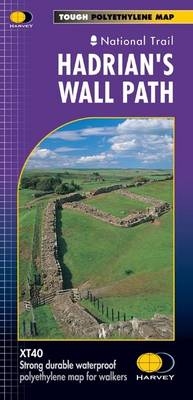
Hadrian's Wall
Seiten
2019
Harvey Map Services Ltd (Verlag)
978-1-85137-438-0 (ISBN)
Harvey Map Services Ltd (Verlag)
978-1-85137-438-0 (ISBN)
Tough & durable. XT40 - virtually indestructible. Light, compact. Entire route on one sheet. Clear easy to read. Sites of Roman remains. Accommodation and services. Great value for money.
Entire route on one map
Hadrian’s Wall Path is a National Trail and runs 130km (81 miles) from the Solway Coast to Newcastle.
The sites of Roman remains are marked on the map, with an enlargement of Housesteads.
Tough, light, durable and 100% waterproof
Includes Rights of Way
Route clearly marked
Entire route on one map
Hadrian’s Wall Path is a National Trail and runs 130km (81 miles) from the Solway Coast to Newcastle.
The sites of Roman remains are marked on the map, with an enlargement of Housesteads.
Tough, light, durable and 100% waterproof
Includes Rights of Way
Route clearly marked
| Erscheint lt. Verlag | 30.8.2019 |
|---|---|
| Reihe/Serie | Trail Map XT40 |
| Zusatzinfo | 1 map |
| Verlagsort | Perthshire |
| Sprache | englisch |
| Maße | 115 x 245 mm |
| Gewicht | 30 g |
| Themenwelt | Sachbuch/Ratgeber ► Sport |
| Reisen ► Karten / Stadtpläne / Atlanten ► Europa | |
| ISBN-10 | 1-85137-438-8 / 1851374388 |
| ISBN-13 | 978-1-85137-438-0 / 9781851374380 |
| Zustand | Neuware |
| Haben Sie eine Frage zum Produkt? |
Mehr entdecken
aus dem Bereich
aus dem Bereich
Straßen- und Freizeitkarte 1:250.000
Karte (gefalzt) (2023)
Freytag-Berndt und ARTARIA (Verlag)
CHF 19,90
Karte (gefalzt) (2023)
Freytag-Berndt und ARTARIA (Verlag)
CHF 19,90
Östersund
Karte (gefalzt) (2023)
Freytag-Berndt und ARTARIA (Verlag)
CHF 21,90


