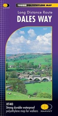
Dales Way
Seiten
2019
Harvey Map Services Ltd (Verlag)
978-1-85137-428-1 (ISBN)
Harvey Map Services Ltd (Verlag)
978-1-85137-428-1 (ISBN)
Entire route on one map, 100% waterproof, practically indestructable, half the weight of a laminated map, GPS compatible, facilities & services, clear & easy to read.
Entire route on one map
The Cumbria Way is 112km (70 miles) from Ulverston to Carlisle. It passes through Coniston, Dungeon Ghyll, Keswick and Caldbeck.
The route passes mostly through valleys rather than over high tops.
Tough, light, durable and 100% waterproof
Includes Rights of Way
Route clearly marked
| Erscheint lt. Verlag | 28.6.2019 |
|---|---|
| Reihe/Serie | Trail Map XT40 |
| Zusatzinfo | 1 map |
| Verlagsort | Perthshire |
| Sprache | englisch |
| Maße | 115 x 245 mm |
| Gewicht | 30 g |
| Themenwelt | Sachbuch/Ratgeber ► Sport |
| Reisen ► Karten / Stadtpläne / Atlanten ► Europa | |
| ISBN-10 | 1-85137-428-0 / 1851374280 |
| ISBN-13 | 978-1-85137-428-1 / 9781851374281 |
| Zustand | Neuware |
| Haben Sie eine Frage zum Produkt? |
Mehr entdecken
aus dem Bereich
aus dem Bereich
Straßen- und Freizeitkarte 1:250.000
Karte (gefalzt) (2023)
Freytag-Berndt und ARTARIA (Verlag)
CHF 19,90
Karte (gefalzt) (2023)
Freytag-Berndt und ARTARIA (Verlag)
CHF 19,90
Östersund
Karte (gefalzt) (2023)
Freytag-Berndt und ARTARIA (Verlag)
CHF 21,90


