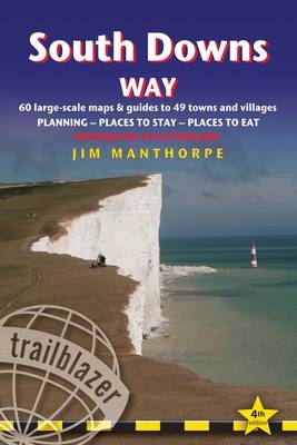
South Downs Way: Trailblazer British Walking Guide
Trailblazer Publications (Verlag)
978-1-905864-42-3 (ISBN)
- Titel erscheint in neuer Auflage
- Artikel merken
Practical guide to walking the whole of the South Downs Way National Trail. Includes: 60 large scale detailed walking maps (1:20,000). Detailed accommodation guide: B&Bs, hotels, campsites, camping barns, hostels. Detailed public transport information. Itineraries for all South Downs Way walks, including the complete trail and day and weekend walks. Where to eat: cafes, pubs and restaurants; what to see. Overview South Downs Way map and stage maps with contours to show hills and descents. Downloadable GPS waypoints. Colour pictures and 4 page colour flower and butterfly guide.
Jim Manthorpe has trekked in many of the world's mountainous regions from Patagonia to the Himalaya and Scandinavia to the Canadian Rockies. Since 1999 he's been a freelance travel writer, photographer and lecturer. He is the author of three other Trailblazer guidebooks: Pembrokeshire Coast Path, Scottish Highlands - The Hillwalking Guide, Tour du Mont Blanc. He has also researched and updated numerous other Trailblazer titles. Jim lived for seven years on the west coast of Scotland in Knoydart, the remotest inhabited place in mainland Britain. As well as writing guidebooks Jim works as a wildlife photographer and film-maker.
INTRODUCTION About the South Downs Way History 9 - How difficult is the path? 10 - How long do you need? 12 Festivals and annual events 13 - When to go 13 - Seasons 13 Temperature 15 - Rainfall 15 - Daylight hours 15 PART 1: PLANNING YOUR WALK Practical information for the walker Route finding 17 - Accommodation 18 - Food and drink 20 Other services 23 - Walking companies & baggage carriers 23 Information for foreign visitors 24 - Disabled access 26 Budgeting 27 Itineraries Which direction? 29 - Suggested itineraries 29 Town and village facilities 30 - Side trip to Mount Caburn 32 Day and weekend walks 33 What to take Keep it light 35 - Rucksack 35 - Footwear 36 - Clothing 36 Toiletries 37 - First-aid kit 37 - General items 38 Camping gear 38 - Money 39 - Maps 39 Recommended reading 39 - Sources of further information 40 Getting to and from the South Downs Way Getting to Britain 41 - National transport 41 - Local transport 44 Public transport services 44 - Public transport map 45 PART 2: THE ENVIRONMENT & NATURE Flora and fauna Butterflies 48 - Flora 48 - Trees 50 - Mammals 51 - Reptiles 52 Birds 53 Conservation of the South Downs Government Agencies and Schemes 56 - Campaigning and Conservation Organisations 58 - Beyond Conservation 60 PART 3: MINIMUM IMPACT WALKING & OUTDOOR SAFETY Minimum impact walking Economic impact 61 - Environmental impact 62 - Access 65 The Countryside Code 66 Outdoor safety and health Avoidance of hazards 68 - Footcare 69 - Sunburn 69 Hypothermia 69 - Hyperthermia 70 - Weather forecasts 70 - Dealing with an accident 70 PART 4: ROUTE GUIDE AND MAPS Using this guide 71 Trail maps 71 Winchester 73 Winchester to Exton 79 (Chilcomb 79, Cheriton 79, Exton 87) Exton to Buriton 87 (East Meon 88, Buriton 94, Petersfield 94) Buriton to Cocking 98 (South Harting 98, Midhurst 102, Cocking 102) Cocking to Amberley 104 (Heyshott 107, Graffham 109, Sutton and Bignor 113, Bury 114, Houghton Bridge 116, Amberley 116, Arundel 119) Amberley to Steyning 122 (Storrington 124, Washington 126, Steyning 130, Bramber and Upper Beeding 132) Steyning to Pyecombe 133 (Truleigh Hill 136, Fulking 136, Poynings 136, Pyecombe 138, Clayton 138) Pyecombe to Southease 140 (Ditchling 140, Plumpton 142, Lewes 145, Kingston-near-Lewes 150, Telscombe 154, Rodmell 154, Southease 156) Southease to Alfriston 156 (West Firle 156, Alciston 156, Berwick 160, Alfriston 160) Alfriston to Eastbourne (coastal route via Cuckmere) 163 (Litlington 163, Westdean & Exceat 154, Seven Sisters Country Park 166, Birling Gap 166, Beachy Head 171, Meads Village 171) Alfriston to Eastbourne (inland route via Jevington) 172 (Milton Street 172, Wilmington 172, Jevington 174) Eastbourne 178 APPENDICES GPS waypoints 182 - Taking a dog along the Way 186 INDEX 188 MAP KEY 191 OVERVIEW MAPS & PROFILES 194
| Erscheint lt. Verlag | 5.11.2012 |
|---|---|
| Reihe/Serie | British Walking Guides |
| Zusatzinfo | 30 colour photos, with 4p flower & butterfly guide, 60 BW walking maps |
| Verlagsort | Hindhead, Surrey |
| Sprache | englisch |
| Maße | 120 x 180 mm |
| Gewicht | 245 g |
| Themenwelt | Sachbuch/Ratgeber ► Sport |
| Reiseführer ► Europa ► Großbritannien | |
| ISBN-10 | 1-905864-42-6 / 1905864426 |
| ISBN-13 | 978-1-905864-42-3 / 9781905864423 |
| Zustand | Neuware |
| Haben Sie eine Frage zum Produkt? |
aus dem Bereich


