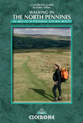
Walking in the North Pennines
Cicerone Press (Verlag)
978-1-85284-493-6 (ISBN)
- Titel erscheint in neuer Auflage
- Artikel merken
A guidebook to day walking in the North Pennines Area of Outstanding Natural Beauty (AONB), across Cumbria, County Durham and Northumberland in the heart of northern England. The book includes 50 walks, from 8km to 23km, suitable for all abilities over a variety of terrain, all illustrated with OS mapping and colour photographs; and full details of local transport services, accommodation and tourist information centres in the area. Most are circular, so that anyone using a car can return to it at the end of the walk, but a few are linear and require the use of public transport for completion. It is easy for everyone to enjoy exploring the North Pennines, as the walking routes suit all abilities, from old, flat railway trackbeds to extensive, pathless, tussocky moorland.
Paddy Dillon is a prolific outdoor writer with over thirty books to his name. He writes for a number of outdoor magazines and other publications, as well as producing information for tourism groups. Paddy has walked and written about every county in England, Scotland, Ireland and Wales. He has walked in many parts of Europe, Nepal, Tibet, Colorado and the Canadian Rockies. He is a member of the Outdoor Writers and Photographers Guild.
INTRODUCTION
Geology
Landscape
Mining
Weather
Flowers and Wildlife
Access to the Countryside
Getting to the North Pennines
Getting Around the North Pennines
Tourist Information and Visitor Centres
Maps
Emergencies
How to Use This Guidebook
SECTION 1 GELTSDALE
1 Brampton, Gelt and Talkin
2 Hallbankgate and Cold Fell
3 Castle Carrock and Geltsdale
4 Croglin, Newbiggin and Croglin Fell
SECTION 2 THE EAST FELLSIDE
5 Hartside, Black Fell and Renwick
6 Melmerby and Knapside Hill
7 Maiden Way - Kirkland to Alston
8 Blencarn, Cross Fell and Kirkland
9 Knockergill Pass - Knock to Garrigill
10 Dufton, Great Rundale and High Cup
SECTION 3 WARCOP RANGE
11 Murton, Murton Pike and Murton Fell
12 Hilton and Tinside Rigg
13 Mickle Fell via the Boundary Route
SECTION 4 STAINMORE
14 North Stainmore and Slate Quarry Moss
15 Kirkby Stephen and Nine Standards
16 The Tan Hill Inn and Sleightholme Moor
17 Bowes and Bowes Moor
SECTION 5 LOWER TEESDALE
18 Greta Bridge and Brignall Banks
19 Barnard Castle and the Tees
20 Woodland and Copley
21 Cotherstone and Romaldkirk
SECTION 6 MIDDLE TEESDALE
22 Tees Railway Walk
23 Middleton and Monk's Moor
24 Middleton and Grassholme
SECTION 7 UPPER TEESDALE
25 Low Force and High Force
26 Holwick and Hagworm Hill
27 Cronkley Fell
28 Cow Green and Widdybank Fell
29 Cow Green and Herdship Fell
SECTION 8 WEARDALE
30 Wolsingham and Frosterley
31 Stanhope and Stanhope Dene
32 Westgate, Middlehope and Rookhope
33 Chapelfell Top and Noon Hill
34 Rookhope to Stanhope
SECTION 9 DERWENTSIDE
35 Waskerley Way - Parkhead to Consett
36 Edmundbyers and Edmundbyers Common
37 Blanchland and Blanchland Moor
SECTION 10 DEVIL'S WATER
38 Devil's Water and Hangman Hill
39 Dipton Mill and Dipton Burn
SECTION 11 ALLENDALE
40 Allen Banks and Staward Gorge
41 Allendale Town and Hexhamshire Common
42 Allendale Town and Allenmill Flues
43 Ninebanks, Hard Rigg and the Dodd
SECTION 12 SOUTH TYNEDALE
44 Alston, Garrigill and River South Tyne
45 Alston, Lambley and Haltwhistle
46 Slaggyford and Grey Nag
SECTION 13 THE DALE-HEADS
47 Allenheads and Killhope Law
48 Cowshill and Killhope
49 Killhope Cross and Knoutberry Hill
50 Nenthead and Nag's Head
APPENDIX 1 Route Summary Table
APPENDIX 2 North Pennines Administration Contacts
APPENDIX 3 Public Transport
APPENDIX 4 Tourist Information and Visitor Centres
| Erscheint lt. Verlag | 14.5.2009 |
|---|---|
| Zusatzinfo | 60 colour maps and over 100 colour photographs |
| Verlagsort | Kendal |
| Sprache | englisch |
| Maße | 116 x 172 mm |
| Gewicht | 310 g |
| Themenwelt | Sachbuch/Ratgeber ► Sport |
| Reiseführer ► Europa ► Großbritannien | |
| ISBN-10 | 1-85284-493-0 / 1852844930 |
| ISBN-13 | 978-1-85284-493-6 / 9781852844936 |
| Zustand | Neuware |
| Haben Sie eine Frage zum Produkt? |
aus dem Bereich


