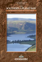
The Southern Upland Way
Cicerone Press (Verlag)
978-1-85284-409-7 (ISBN)
- Titel ist leider vergriffen;
keine Neuauflage - Artikel merken
The Southern Upland Way is Scotland's Coast-to-Coast walk and the longest of the National Trails north of the Border. It runs for 212 miles (341km) from picturesque Portpatrick on the west coast across the Galloway and Border Hills to finish on the east coast at Cockburnspath south of Dunbar. On the way it passes through remote and romantic country and visits many of the locations associated with Scotland's often turbulent past. The guidebook divides the walk into 13 stages of varying length that will fill a two-week walking holiday in this relatively unknown area of Britain. Possibilities for shorter walking holidays along the Way are also fully discussed. The walk is at times a somewhat strenuous one, but advice is given as to how all of the longer stages may be broken down into shorter more manageable sections. The guide is packed with information on the many places of interest passed en route and the historical connections are thoroughly discussed. All that is needed to turn the Southern Upland Way into a successful and enjoyable holiday experience is contained in this guide.
Alan Castle is a writer and photographer specialising in the outdoors, walking, backpacking, mountain walking, trekking and travel in the UK, Europe and worldwide. His interests include UK and European long distance trails, challenge walking, Munros and peak bagging, and adventure travel - he leads several walking holidays throughout Europe each year. He is an occasional contributor to a number of walking magazines and is a Fellow of the Royal Geographical Society and a member of the Austrian Alpine Club.
PART 1 - INTRODUCTION
The Southern Upland Way
Which way to go: West to East or East to West?
What time of Year to walk the Trail?
Ways of tackling the SUW
Luggage transport and drop-off/pick-up services
Accommodation along the SUW
Getting to and from the SUW
Planning: what to do before you leave home
Equipment
Maps
Navigating along the SUW
Access in Scotland
SUW Information Leaflets and Boards
The E2
Ticks
Completion Certificates and SUW Badges
A High Level Alternative Coast-to-Coast
Notes on using this guidebook
PART 2 - TRAIL GUIDE
Stage 1 Portpatrick to Castle Kennedy
Stage 2 Castle Kennedy to New Luce
Stage 3 New Luce to Bargrennan
Stage 4 Bargrennan to St John's Town of Dalry
Stage 5 St John's Town of Dalry to Sanquhar
Stage 6 Sanquhar to Wanlockhead
Stage 7 Wanlockhead to Beattock (Moffat)
Rest Day Moffat and environs
Stage 8 Beattock (Moffat) to Tibbie Shiels (St Mary's Loch)
Stage 9 Tibbie Shiels (St Mary's Loch) to Traquair (Innerleithen)
Stage 10 Traquair (Innerleithen) to Melrose
Stage 11 Melrose to Lauder
Stage 12 Lauder across the Lammermuir Hills to Longformacus
Stage 13 Longformacus to Cockburnspath
APPENDICES
Appendix 1 Bothies along the SUW
Appendix 2 Bibliography
Appendix 3 Useful Addresses, Telephone Numbers and Websites
| Erscheint lt. Verlag | 5.2.2013 |
|---|---|
| Zusatzinfo | 65 colour photos and over 30 OS maps |
| Verlagsort | Kendal |
| Sprache | englisch |
| Maße | 116 x 172 mm |
| Gewicht | 290 g |
| Themenwelt | Sachbuch/Ratgeber ► Sport |
| Reiseführer ► Europa ► Großbritannien | |
| Reiseführer ► Europa ► Schottland | |
| ISBN-10 | 1-85284-409-4 / 1852844094 |
| ISBN-13 | 978-1-85284-409-7 / 9781852844097 |
| Zustand | Neuware |
| Haben Sie eine Frage zum Produkt? |
aus dem Bereich


