The Thames Path
Cicerone Press (Verlag)
978-1-78631-148-1 (ISBN)
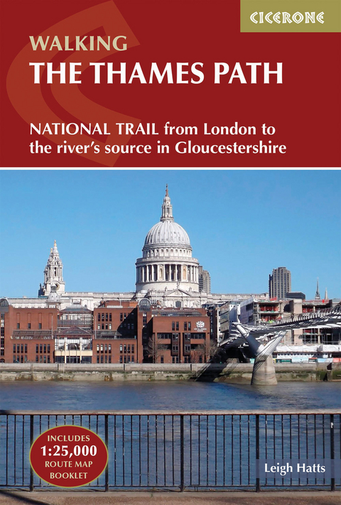
A guidebook to walking the Thames Path National Trail between Woolwich Foot Tunnel in east London and the river's source in Gloucestershire. Covering 292km (182 miles), this straightforward trail takes around 2 weeks to hike. A level walk alongside riverside paths, it makes an ideal first long-distance trail for beginners.
The route is described from east to west in 20 stages between 6 and 26km (4–16 miles) in length. An optional route extension from Erith in Kent to the traditional start at Woolwich Foot Tunnel is also provided.
GPX files available to download
Contains step-by-step description of the route alongside 1:50,000 OS maps
Includes a separate map booklet containing OS 1:25,000 mapping and route line
Handy route summary table helps you plan your itinerary
Refreshment and accommodation information given for each route stage
Public transport by stage is listed for those wanting to break the trail into shorter sections
Leigh Hatts has been walking the Thames towpath and exploring the river and Docklands since 1981, when he worked on the feasibility study that resulted in the decision to establish the route as a National Trail. He worked as a reporter with the walkers' magazine TGO and as arts correspondent of the Catholic Herald. He is co-founder of Bankside Press.
Overview map
Route summary table
Map key
Introduction
Towpath to National Trail
The Path today
Wildlife
Looking after the river
Accommodation and transport
Maps
Safety
Using this guide
The Thames Path
Stage 1 Woolwich Foot Tunnel to Tower Bridge
Stage 2 Tower Bridge to Putney
Stage 3 Putney to Kingston
Stage 4 Kingston to Chertsey
Stage 5 Chertsey to Staines
Stage 6 Staines to Windsor
Stage 7 Windsor to Maidenhead
Stage 8 Maidenhead to Marlow
Stage 9 Marlow to Henley
Stage 10 Henley to Reading
Stage 11 Reading to Pangbourne
Stage 12 Pangbourne to Goring
Stage 13 Goring to Wallingford
Stage 14 Wallingford to Dorchester
Stage 15 Dorchester to Abingdon
Stage 16 Abingdon to Oxford
Stage 17 Oxford to Newbridge
Stage 18 Newbridge to Lechlade
Stage 19 Lechlade to Cricklade
Stage 20 Cricklade to the Source
Appendix A Optional Prelude: Erith to Woolwich Foot Tunnel
Appendix B Further reading
| Erscheinungsdatum | 28.04.2023 |
|---|---|
| Reihe/Serie | Cicerone guidebooks |
| Zusatzinfo | 57 colour photos and 30 maps |
| Verlagsort | Kendal |
| Sprache | englisch |
| Maße | 116 x 172 mm |
| Gewicht | 380 g |
| Themenwelt | Sachbuch/Ratgeber ► Sport |
| Reisen ► Sport- / Aktivreisen ► Europa | |
| ISBN-10 | 1-78631-148-8 / 1786311488 |
| ISBN-13 | 978-1-78631-148-1 / 9781786311481 |
| Zustand | Neuware |
| Haben Sie eine Frage zum Produkt? |
aus dem Bereich
