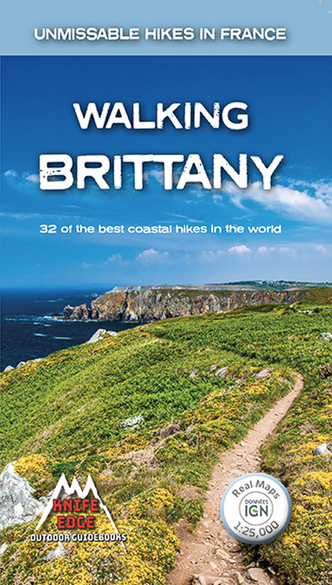
Walking Brittany
Knife Edge Outdoor Limited (Verlag)
978-1-912933-10-5 (ISBN)
Brittany's coastline has 3,000 km of sea frontage - a lifetime's worth of walking along the tops of spectacular and seemingly endless cliffs; around remote rocky headlands and peninsulas jutting out into the Atlantic; and across innumerable white sand beaches which would not be out of place on a Caribbean island. With so much coast on offer, it is understandable that Brittany, and its people, have a strong connection with the sea: evidenced by the countless yachts, fishing boats and other watercraft which are moored in the ports, harbours, bays and estuaries.
The coast of Brittany is vast. So vast that it is not possible to see everything on a single trip. So vast, in fact, that it is difficult to know where to start and that is where this guidebook comes in. To make planning easy, we have included only the very finest of the thousands of possible walks on Brittany's coast.
The guidebook includes Real IGN maps (1:25,000) so there is no need to carry separate maps. It also includes numbered waypoints linking the Real maps to the book's clear descriptions; graded routes to suit all abilities; information on Megalithic and World War II sites and everything else the hiker needs.
Andrew McCluggage is an outdoor writer/photographer. He is from Ireland and has been a keen mountain walker all his life. He has been trekking in the Alps for over two decades. He lives for part of the year in the French Alps and his first book was Walking in the Brianconnais, France. Since then, he has written guidebooks for the Tour du Mont Blanc and the Walker's Haute Route: Chamonix to Zermatt. He was a corporate lawyer for 20 years and was a partner at an international law firm. In 2018 he stopped being a lawyer to start Knife Edge Outdoor Guidebooks
1. Introduction
2. Accommodation
3. Food
4. Getting There
5. Getting Around
6. On the Trail - Weather, Maps, Paths and Waymaking, What to Take
7. Safety
8. Route Summary Table
9. Route Descriptions
- The Dykes of Le Mont St Michel
- Pointe du Grouin
- Pointe du Meinga
- Cap Frehel
- Cap d'Erquy
- The Cliffs of Port Morvan
- Sillon de Talbert
- La Maison entre Les Deux Rochers
- La Cote de Granit Rose
- Pointe de Corsen
- La Prequ'ile de Kermorvan
- The Pen Hir Loop
- Pointe de Dinan
- Cap de la Chevre
- Pointes de Penharn and Brezellec
- Pointe du Raz
- Plage de Tronoan and the The Two Chapels
- Pointe de Combrit
- The Dunes and Point of Trevignon
- The Belon Estuary
- The Doelan Loop
- Ile de Groix: Beach Loop
- Ile do Groix - Cliff Loop
- La Cote Sauvage
- Megalithic Carnac
- La Prequ'ile de Mousterian
- Ile d'Arz
- Arzon
- St-Gildas-de-Rhuys
- Chateau de Suscinio
- Guerande
| Erscheinungsdatum | 17.02.2020 |
|---|---|
| Reihe/Serie | Knife Edge guidebooks |
| Zusatzinfo | Full colour throughout |
| Sprache | englisch |
| Maße | 120 x 210 mm |
| Gewicht | 235 g |
| Themenwelt | Sachbuch/Ratgeber ► Sport |
| Reiseführer ► Europa ► Frankreich | |
| Reisen ► Sport- / Aktivreisen ► Europa | |
| ISBN-10 | 1-912933-10-1 / 1912933101 |
| ISBN-13 | 978-1-912933-10-5 / 9781912933105 |
| Zustand | Neuware |
| Haben Sie eine Frage zum Produkt? |
aus dem Bereich


