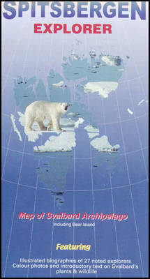
Spitsbergen Explorer
Visitor's Map of the Svalbard Archipelago (Norway)
2001
Ocean Explorer Maps (Verlag)
978-0-9538618-1-1 (ISBN)
Ocean Explorer Maps (Verlag)
978-0-9538618-1-1 (ISBN)
Covers the Arctic archipelago (named Spitsbergen when discovered by the Dutch in 1596, but now commonly referred to as Svalbard). This title features a map of the archipelago, with annotations. It includes biographical summaries of 27 explorers as well as descriptions and colour photographs of the common plants, invertebrates, birds and mammals.
A fold-out visitor's map (scale 1 : 1,000,000), that measures approximately 75 x 46 cm (W x H) when unfolded. Covers the famous Arctic archipelago (named Spitsbergen when discovered by the Dutch in 1596, but now more commonly referred to as Svalbard - the Viking word for 'cold coast'). On one side there is a clear and uncluttered map of the archipelago, with useful annotations; on the reverse there are excellent biographical summaries of 27 noted explorers (including Horatio Nelson who came here as a 14 year old midshipman!) plus brief descriptions and colour photographs of the more common plants, invertebrates, birds and mammals.
A fold-out visitor's map (scale 1 : 1,000,000), that measures approximately 75 x 46 cm (W x H) when unfolded. Covers the famous Arctic archipelago (named Spitsbergen when discovered by the Dutch in 1596, but now more commonly referred to as Svalbard - the Viking word for 'cold coast'). On one side there is a clear and uncluttered map of the archipelago, with useful annotations; on the reverse there are excellent biographical summaries of 27 noted explorers (including Horatio Nelson who came here as a 14 year old midshipman!) plus brief descriptions and colour photographs of the more common plants, invertebrates, birds and mammals.
Map of Spitsbergen; the explorers; plants; invertebrates; birds; mammals
| Erscheint lt. Verlag | 31.12.2001 |
|---|---|
| Reihe/Serie | Ocean Explorer Maps |
| Co-Autor | Beau Riffenburgh, Liz Cruwys |
| Illustrationen | Olle Carlsson |
| Zusatzinfo | colour & b/w photos, b/w illustrations, colour maps, scale: 1 : 1 000 000; dimensions 75 × 46 cm |
| Verlagsort | Chichester |
| Sprache | englisch |
| Maße | 125 x 230 mm |
| Themenwelt | Reisen ► Karten / Stadtpläne / Atlanten ► Welt / Arktis / Antarktis |
| ISBN-10 | 0-9538618-1-3 / 0953861813 |
| ISBN-13 | 978-0-9538618-1-1 / 9780953861811 |
| Zustand | Neuware |
| Haben Sie eine Frage zum Produkt? |
Mehr entdecken
aus dem Bereich
aus dem Bereich
1:30 Mio. mit Posterleisten, mit Oberflächenlaminat
Karte (gerollt) (2023)
INTERKART Landkarten & Globen (Verlag)
CHF 32,90


