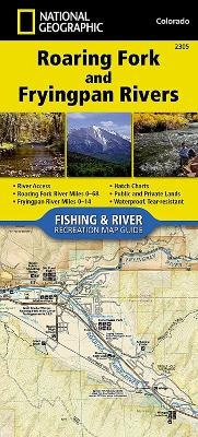
Roaring Fork And Fryingpan Rivers
Seiten
2018
|
2018th ed.
National Geographic Maps (Verlag)
978-1-56695-753-3 (ISBN)
National Geographic Maps (Verlag)
978-1-56695-753-3 (ISBN)
- Keine Verlagsinformationen verfügbar
- Artikel merken
Waterproof, Tear-Resistant Fishing & River Map. The Roaring Fork and Fryingpan Rivers Fishing & River Map Guide is designed to be the perfect companion to anyone recreating on either of these two iconic Colorado rives. The Roaring Fork begins at Independence Pass and passes through the towns of Aspen, Basalt, and Carbondale before finally joining the mighty Colorado at Glenwood Springs. Along the way, it covers 68 river miles and drops 6,700 feet in elevation and morphs from a small mountain stream into a mighty and powerful waterway known as 'Thunder River' by the local Ute Indians struck by its imposing roar. Numerous recreational opportunities are available from fishing along the Rail-to-Trails converted Rio Grande Trail that follows the river for most of its length to running the class IV rapids just downstream from Aspen. The Fryingpan River is known primarily for its Gold Medal waters that start at Ruedi Reservoir Dam and continue all the way to the confluence of the Roaring For
| Erscheint lt. Verlag | 20.6.2018 |
|---|---|
| Verlagsort | Evergreen |
| Sprache | englisch |
| Maße | 1 x 1 mm |
| Themenwelt | Reisen ► Karten / Stadtpläne / Atlanten ► Nord- / Mittelamerika |
| Reiseführer ► Nord- / Mittelamerika ► USA | |
| ISBN-10 | 1-56695-753-2 / 1566957532 |
| ISBN-13 | 978-1-56695-753-3 / 9781566957533 |
| Zustand | Neuware |
| Haben Sie eine Frage zum Produkt? |
Mehr entdecken
aus dem Bereich
aus dem Bereich
Karte (gefalzt) (2024)
Michelin Editions des Voyages (Verlag)
CHF 20,55
Map
Karte (gefalzt) (2024)
Michelin Editions des Voyages (Verlag)
CHF 15,90


