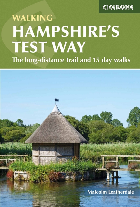
Walking Hampshire's Test Way
The long-distance trail and 15 day walks
Seiten
2021
Cicerone Press (Verlag)
978-1-85284-953-5 (ISBN)
Cicerone Press (Verlag)
978-1-85284-953-5 (ISBN)
Guidebook to walking the 71km (44 mile) Test Way in Hampshire from high on the chalk downs of Inkpen Beacon to the Eling Tide Mill near Southampton Water. Following the beautiful, crystal clear River Test, it passes picturesque villages and fascinating historic sites. Also includes 15 day walks to explore this lovely part of pastoral England.
A guidebook to walking the Test Way between Inkpen Beacon in the North Wessex Downs and Eling Tide Mill near Southampton Water. Covering 71km (44 miles), this riverside route makes a gentle 8-day walk, though stages can be combined into a shorter 2–3 day overall journey. Also included are 15 circular day walks exploring the chalk downs and rolling countryside in and around the Test valley.
The Test Way is described in 8 stages of 5–14km (3–9 miles) in length, while the day walks range from 6–14km (4–9 miles). All the described routes can be walked year-round and are suitable for walkers of all abilities, taking between 2 and 4 hours to complete.
1:50,000 OS maps included for each walk
GPX files available to download
Refreshment and public transport options are given for each walk
Information on local history, geology and wildlife
Easy access from Newbury, Basingstoke, Winchester, Southampton
Malcolm Leatherdale has a particular interest in walking and exploring his native Hampshire. He has lived for the past 15 years a stone's throw away from the River Test and the Test Way. Malcolm is an active cyclist and also a former marathon runner having competed several times in the London Marathon - the training for which took him along the byways of the Test Valley and helped increase his local knowledge. He has written several books and has had a number of articles published as well as photographs.
| Erscheinungsdatum | 28.07.2018 |
|---|---|
| Reihe/Serie | Cicerone guidebooks |
| Zusatzinfo | 74 pics 24 maps |
| Verlagsort | Kendal |
| Sprache | englisch |
| Maße | 116 x 172 mm |
| Gewicht | 180 g |
| Themenwelt | Sachbuch/Ratgeber ► Sport |
| Reiseführer ► Europa ► Großbritannien | |
| Reisen ► Sport- / Aktivreisen ► Europa | |
| ISBN-10 | 1-85284-953-3 / 1852849533 |
| ISBN-13 | 978-1-85284-953-5 / 9781852849535 |
| Zustand | Neuware |
| Haben Sie eine Frage zum Produkt? |
Mehr entdecken
aus dem Bereich
aus dem Bereich
individuell reisen mit vielen praktischen Tipps
Buch | Softcover (2024)
Michael Müller (Verlag)
CHF 43,90
Reiseführer mit Stadtplan, 4 Spaziergängen und kostenloser Web-App
Buch | Softcover (2023)
Reise Know-How (Verlag)
CHF 22,90


