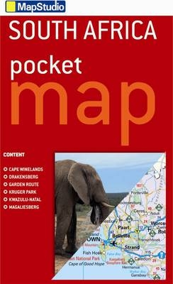
Pocket tourist map South Africa
2012
|
7th ed
Map Studio (Verlag)
978-1-77026-365-9 (ISBN)
Map Studio (Verlag)
978-1-77026-365-9 (ISBN)
- Titel wird leider nicht erscheinen
- Artikel merken
This detailed map of South Africa at 1:3 600 000 scale provides an index to places names. Includes detailed area maps of Kruger National Park, the Garden Route, Cape Winelands, Drakensberg, Magaliesberg and Kwazulu-Natal coast. The map shows places of interest, wine estates, national parks and nature reserves, historical sites, accommodation, toll routes, route numbers and includes a distance table.
| Erscheint lt. Verlag | 1.4.2012 |
|---|---|
| Verlagsort | Cape Town |
| Sprache | englisch |
| Maße | 100 x 140 mm |
| Gewicht | 40 g |
| Themenwelt | Reisen ► Karten / Stadtpläne / Atlanten ► Afrika |
| ISBN-10 | 1-77026-365-9 / 1770263659 |
| ISBN-13 | 978-1-77026-365-9 / 9781770263659 |
| Zustand | Neuware |
| Haben Sie eine Frage zum Produkt? |
Mehr entdecken
aus dem Bereich
aus dem Bereich
Karte (gefalzt) (2024)
Freytag-Berndt und ARTARIA (Verlag)
CHF 18,95
Karte (gefalzt) (2023)
Freytag-Berndt und ARTARIA (Verlag)
CHF 21,90
reiß- und wasserfest (world mapping project)
Karte (gefalzt) (2024)
Reise Know-How (Verlag)
CHF 17,90


