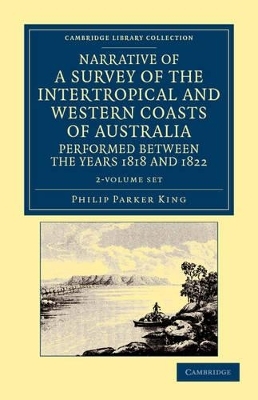
Narrative of a Survey of the Intertropical and Western Coasts of Australia, Performed between the Years 1818 and 1822 2 Volume Set
Cambridge University Press
978-1-108-04598-8 (ISBN)
- Keine Verlagsinformationen verfügbar
- Artikel merken
This two-volume work by Captain Phillip Parker King (1791–1856) was published in 1827, and describes the Royal Navy's 1817–22 surveying expedition to chart the coastal regions of Australia. King carried out the surveys in two successive ships, the Mermaid, which was declared unseaworthy in 1820, and the newly commissioned Bathurst. He worked on the charts, which were published by the Hydrographic Office, for two years after his return to England. He was made a Fellow of the Royal Society, and later undertook a similar surveying voyage, in which he was accompanied by Captain Fitzroy on the Beagle, around the coast of South America. The book is derived from the author's journal, and describes not only the voyages but also the towns and settlements of the region. Volume 1 covers the south, east and north coasts of Australia, and Volume 2, the north and west coasts.
Volume 1: Introduction; 1. Intended mode of proceeding, and departure from Port Jackson; 2. Examination of Rowley's Shoals, and passage to the North Coast; 3. Tansactions at Coepang; 4. Visit to Van Diemen's Land, and examination of the entrance of Macquarie Harbour; 5. Departure from Port Jackson, and commence a running survey of the East Coast; 6. Transactions at Endeavour River, and intercourse with the natives; 7. Cross the Gulf of Carpentaria, and resume the survey of the North Coast at Wessel's Islands; 8. Examination of the coast between Cape Londonderry and Cape Voltaire, containing the surveys of Sir Graham Moore's Islands, Eclipse Islands, Vansittart Bay, Admiralty Gulf, and Port Warrender; 9. Equipment for the third voyage; 10. Cross the Gulf of Carpenteria, and anchor at Goulburn's South Island. Volume 2: 1. Survey upon the Mermaid; 2. Passage from Cape Van Diemen to Careening Bay; 3. Departure from Port Louis; 4. Leave King George the Third's Sound, and commence the survey of the West Coast at Rottnest Island; 5. The Bathurst sails for England; Appendix.
| Reihe/Serie | Cambridge Library Collection - Maritime Exploration |
|---|---|
| Zusatzinfo | 14 Plates, black and white; 1 Maps; 14 Halftones, unspecified |
| Verlagsort | Cambridge |
| Sprache | englisch |
| Maße | 141 x 216 mm |
| Gewicht | 1580 g |
| Themenwelt | Reisen ► Reiseberichte ► Australien / Neuseeland / Ozeanien |
| Geisteswissenschaften ► Geschichte ► Regional- / Ländergeschichte | |
| Naturwissenschaften ► Geowissenschaften ► Geografie / Kartografie | |
| ISBN-10 | 1-108-04598-7 / 1108045987 |
| ISBN-13 | 978-1-108-04598-8 / 9781108045988 |
| Zustand | Neuware |
| Haben Sie eine Frage zum Produkt? |