Teaching Mathematics Using Interactive Mapping
CRC Press (Verlag)
978-1-032-30533-2 (ISBN)
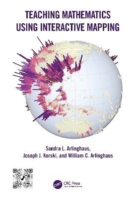
Teaching Mathematics Using Interactive Mapping offers novel ways to learn basic math topics such as simple relational measures or measuring hierarchies through customized interactive mapping activities. These activities focus on interactive web-based Geographic Information System (GIS) and are relevant to today’s problems and challenges. Written in a guided, hands-on, understandable manner, all activities are designed to build practical and problem-solving skills that rest on mathematical principles and move students from thinking about maps as references that focus solely on "where is" something, to analytical tools, focusing primarily on the "whys of where." Success with this transition through interaction permits most readers to master mathematical concepts and GIS tools.
FEATURES
Offers custom-designed geographical activities to fit with specific mathematical topics
Helps students become comfortable using mathematics in a variety of professions
Provides an innovative, engaging, and practical set of activities to ease readers through typically difficult, often elementary, mathematical topics: fractions, the distributive law, and much more
Uses web-based GIS maps, apps, and other tools and data that can be accessed on any device, anywhere, at any time, requiring no prior GIS background
Written by experienced teachers and researchers with lifelong experience in teaching mathematics, geography, and spatial analysis
Features an accompanying Solution Guide, available on the book's product page, that is beneficial for instructors, students, and other readers as an aid to gauging progress.
This textbook applies to undergraduate and graduate students in universities and community colleges including those in basic mathematics courses, as well as upper-level undergraduate and graduate students taking courses in geographic information systems, remote sensing, photogrammetry, geography, geodesy, information science, engineering, and geology. Professionals interested in learning techniques and technologies for collecting, analyzing, managing, processing, and visualizing geospatial datasets will also benefit from this book as they refresh their knowledge in mathematics.
Sandra L. Arlinghaus, PhD, is a mathematical geographer. She holds a PhD in geography from the University of Michigan and has PhD-level training in pure mathematics from the University of Chicago (algebra), the University of Toronto (geometry), and Wayne State University (graph theory). Dr. Arlinghaus has published over 400 books and articles, many in peer-reviewed publications. She is currently Adjunct Professor, School for Environment and Sustainability, University of Michigan, Ann Arbor. Joseph J. Kerski, PhD, is a geographer, educator, and GIS professional who has served in four major sectors of society: government, academia, private industry, and nonprofit organizations. His career focus is the implementation and effectiveness of geotechnologies across all learning domains. Dr. Kerski holds three degrees, all in geography, and has worked extensively with those in career and technology education, earth and environmental science, geography, history, and mathematics. William C. Arlinghaus, PhD, holds a PhD in pure mathematics and is Professor Emeritus of Mathematics and Computer Science at Lawrence Technological University, Southfield, Michigan. He has taught all levels of undergraduate university mathematics and computer science and has extensive administrative experience, including service as Department Chair. In total, he has published over 50 books and articles in the USA and abroad.
1. Classifying Numbers and the Distributive Law. 2. Fractions and Decimals. 3. Simple Relational Measures and Measures of Central Tendency and Variation. 4. Earth Measurement: Coordinate Systems and Trigonometry. 5. Data, Variables, and Thematic Maps. 6. Mathematics’ Foundations: Set Theory and Algebra. 7. Mathematics’ Foundations: Dimension and Geometry. 8. Proximity and Adjacency: Measurement. 9. Measuring Hierarchies and Patterns.
| Erscheinungsdatum | 13.12.2023 |
|---|---|
| Zusatzinfo | 74 Line drawings, color; 6 Line drawings, black and white; 147 Halftones, color; 48 Halftones, black and white; 221 Illustrations, color; 54 Illustrations, black and white |
| Verlagsort | London |
| Sprache | englisch |
| Maße | 178 x 254 mm |
| Gewicht | 553 g |
| Themenwelt | Schulbuch / Wörterbuch |
| Mathematik / Informatik ► Mathematik ► Angewandte Mathematik | |
| Naturwissenschaften ► Geowissenschaften ► Geografie / Kartografie | |
| Sozialwissenschaften ► Pädagogik | |
| Technik ► Umwelttechnik / Biotechnologie | |
| ISBN-10 | 1-032-30533-9 / 1032305339 |
| ISBN-13 | 978-1-032-30533-2 / 9781032305332 |
| Zustand | Neuware |
| Haben Sie eine Frage zum Produkt? |
aus dem Bereich


